Irony !
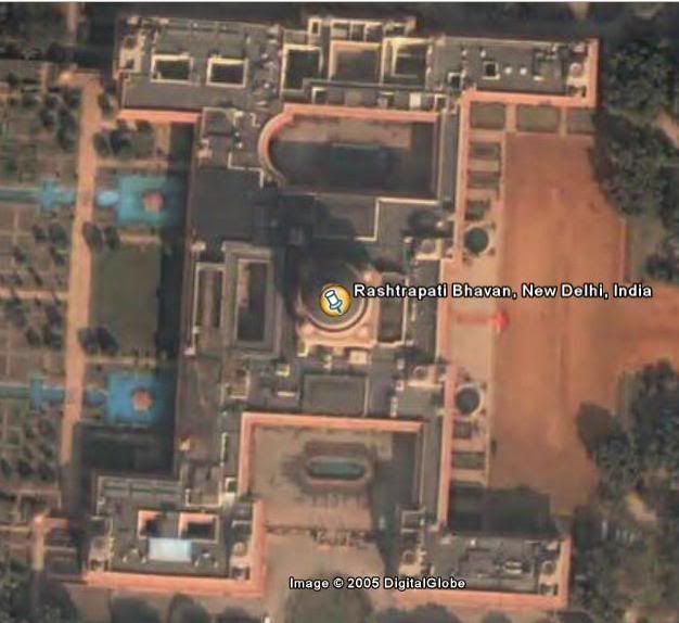
If you happen to fly over India using GoogleEarth you will notice that the only place that has very high resolution satellite image is the Rashtrapathi Bhavan. This area has an high resolution image up to the altitude of 1800 feet. Surprisingly, no other place has such high resolution image, the best image for other places is at 40,000 feet. What is ironical is that, the White House has been intentionally blured and does not have a high resolution image. Isn't there a law governing remote sensing over India ? shouldn't civilian and commercial use of remote sensing data be regulated ? It seems like it's properly reviewed and regulated in the US but they don't seem to care much about the third world nations. In a way this also suggests something about US' foriegn policy and attitude towards India when it comes to national security.


1 Comments:
Absolutely agree with u. There need to be laws governing this sort of surveillance.
By mayank, at 2:09 am, August 20, 2005
Post a Comment
<< Home